Description
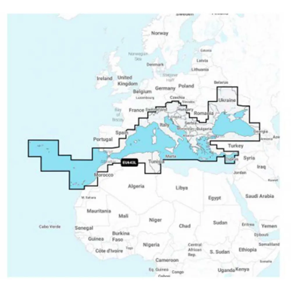
NAVIONICS NAEU643L-Mediterranean And Black Sea EU643L-Large Map
Navigate the stunning and historic waters of the Mediterranean and Black Sea with unparalleled confidence and detail using the NAVIONICS NAEU643L Navionics+ Large chart. Designed for the most discerning mariners, anglers, and sailing enthusiasts, this premium electronic cartography solution transforms your compatible chartplotter into a powerful navigation tool. Experience a new level of situational awareness, whether you are charting a course through the Greek isles, fishing off the coast of Italy, or exploring the vast expanse of the Black Sea. This all-in-one solution provides the comprehensive data you need for safer, smarter, and more enjoyable journeys on the water.
EU643L – MSD – Navionics+ Large – Mediterranean and Black Sea.
Navionics+ is the electronic charting standard that offers the most content and the best value for marine areas and lakes the most detailed all-in-one cartography for seas and lakes makes Navionics+ the perfect choice for boating and fishing.
Now you can have the most accurate navigation data for your navigation system, an exclusive HD bathymetric map with intervals every 0.5 m improved by the contributions of other sailors like you, and the local data published by the users of our apps.
Thousands of edits are processed at Navionics every day so you always have the most up-to-date charts available.
Daily updates and advanced features are included for one year.
Key Benefits and Main Features
* Comprehensive All-in-One Cartography: Integrate official hydrographic office data with private sources to get the most complete and detailed charts available for the Mediterranean and Black Sea. Enjoy a seamless experience with data for offshore and inland navigation presented in a clear, easy-to-read format.
* High-Definition Bathymetry: Gain a significant advantage with SonarChart™, an exclusive HD bathymetric map featuring extraordinary bottom contour detail with intervals as precise as 0.5 meters (1 ft). It is perfect for locating fishing spots, identifying drop-offs, and navigating shallow areas with increased awareness.
* Continuous Chart Updates: Your world on the water is constantly changing. With a one-year subscription to daily updates, you get access to the freshest chart data. Benefit from thousands of edits made every day to Nautical Chart, SonarChart, and Community Edits to ensure you are navigating with the most current information.
* Advanced Navigation Features: Enhance your route planning with Dock-to-dock Autorouting, a breakthrough feature that calculates a suggested path from a real start point to a real end point. It considers chart data, navigation aids, and water depth to create a detailed route.
* Community-Powered Insights: Leverage the power of the boating community with Community Edits. View and contribute valuable local knowledge, such as buoys, lights, rocks, moorings, and other points of interest, directly on your chart.
Technical Specifications
* Product Code: NAEU643L
* Coverage Area: Full coverage of the Mediterranean Sea and the Black Sea.
* Format: MSD (MicroSD Card)
Reviews
There are no reviews yet.