Description
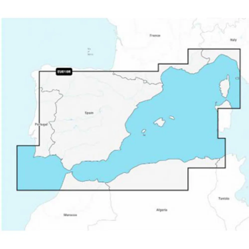
NAVIONICS NAEU010R-Spain Mediterranean Coast EU010R-Regular Map
Navigate the stunning Spanish Mediterranean Coast with unparalleled confidence and detail using the NAVIONICS NAEU010R Regular map. This premier electronic cartography solution is engineered for boaters, sailors, and anglers who demand accuracy, reliability, and the most current data for their journeys. Unlock a superior navigation experience on your compatible chartplotter, whether you are planning a long-distance voyage, searching for the perfect anchorage, or exploring new fishing grounds along the vibrant Mediterranean shoreline of Spain.
This advanced cartography solution provides a comprehensive, all-in-one data set that brings the seabed and coastal features to life. Enhance your situational awareness and make more informed decisions on the water with a wealth of information at your fingertips.
Main Features:
* Nautical Chart: Access a complete and robust chart resource, offering a clear and precise representation of shorelines, spot soundings, navigation aids, port plans, and tidal information.
* SonarChart™ HD Bathymetry: Explore the seafloor with exceptional clarity. This high-definition layer features extraordinary bottom contour detail with intervals as precise as 0.5 meters (1 ft), perfect for locating fish-holding structures and navigating shallow areas.
* Community Edits: Benefit from a network of local knowledge with valuable points of interest and chart data corrections contributed by millions of Navionics and Garmin users.
* Dock-to-dock Autorouting: Quickly calculate a detailed route, even through narrow passages and channels, based on chart data and navigation aids for smarter and more efficient trip planning.
* Advanced Map Options: Customize your chart view to highlight shallow areas, adjust contour density, and target specific fishing ranges for a truly personalized navigation experience.
* Plotter Sync: Seamlessly transfer routes, markers, and chart updates between your compatible chartplotter and the Navionics Boating app on your mobile device.
EU010R – MSD – Navionics+ Regular – Spanish Mediterranean Coasts.
Navionics+ is the electronic cartography standard that offers more content and the best value for marine areas and lakes the most detailed, all-in-one cartography for seas and lakes makes Navionics+ the perfect choice for boating and fishing.
Now you can have the most accurate navigation data for your navigation system, an exclusive HD bathymetric map with intervals every 0.5 m improved by the contributions of other sailors like you, and the local data published by the users of our apps.
Thousands of edits are processed at Navionics every day so you always have the most up-to-date charts available.
Daily updates and advanced features are included for one year.
Technical Specifications and Coverage:
This product, model NAEU010R, provides extensive cartographic coverage for the Mediterranean coast of Spain. As part of the Navionics+ Regular series, it delivers an exceptional standard of detail essential for all marine activities. Your purchase includes a one-year subscription to daily updates and advanced features, ensuring your charts reflect the very latest information and that you always have the best possible tool for safe and enjoyable navigation

Reviews
There are no reviews yet.